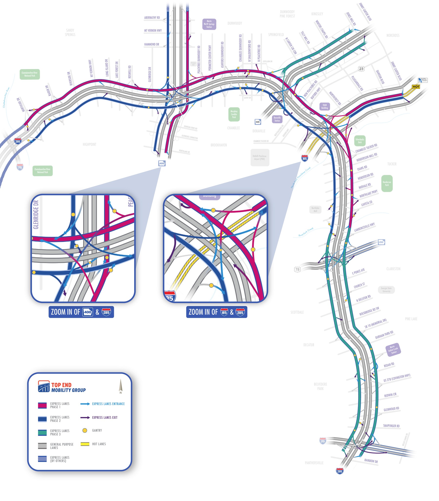
An interactive overview of the proposed I-285 East express lane corridor — built to give stakeholders a clear, navigable view of the alignment, key interchanges, and segment-level detail in one place.
This is a presentation-ready, customer-friendly corridor map covering the full I-285 Express Lanes corridor in Atlanta, Georgia — 30 miles of corridor (approximately 60 directional miles) from the Chattahoochee River to the I-20 interchange, plus the SR 141 connector between I-285 and Crooked Creek. It brings together roadway geometry, interchange configurations, toll gantries, and access points into one consistent visual system across all three project phases.
Use the interactive map below to explore the full corridor, zoom into specific interchanges, or filter the segment and facility directory by phase for a closer look at each stretch of the alignment.
Click anywhere on the map to zoom in, use the toolbar for precise zoom/pan control, or filter by phase to jump to that phase's segments and facilities below.
Filter by phase or type to browse all 12 facilities and 38 toll segments mapped across the corridor.
Download the complete project proposal and supporting corridor map documentation.
⬇ Download Full ProposalA Ferrovial company — efficient and innovative solutions to global mobility needs.
Contact the Project Team